Global Positioning System (Gps)
What Is the Global Positioning System (GPS)?
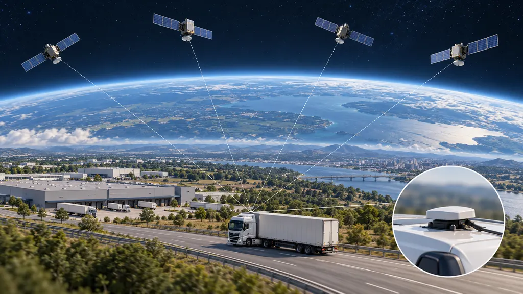
The Global Positioning System (GPS) is a United States-owned satellite-based system that provides positioning, navigation, and timing information to compatible receivers. In logistics, GPS helps determine the location and movement of vehicles, vessels, and tracking devices attached to transport equipment or cargo. It supplies location data that can support fleet monitoring, route navigation, shipment visibility, and delivery operations.
GPS is not, by itself, a shipment tracking service. A receiver calculates its position from satellite signals, while separate equipment and software associate that position with a vehicle or shipment and communicate it to other users. This distinction explains why a device can know its location without being able to display that location on a remote tracking dashboard.
How GPS Works
GPS consists of three principal segments: satellites in space, a ground control network, and user receivers. The satellites broadcast signals containing timing and orbital information. The ground control network monitors and manages the satellite system. Receivers use the broadcast signals to calculate position and time.
A receiver estimates its distance from satellites by measuring how long their signals take to arrive. It then uses these measurements, together with satellite position information, to solve for its own location. A conventional three-dimensional position and receiver clock solution requires measurements from at least four satellites. This process is based on distance measurements, often described as trilateration, rather than on measuring angles.
Positioning and communication are separate operations. A GPS receiver does not need a cellular connection merely to receive satellite signals and calculate a position. However, a logistics tracking device normally needs a separate communication channel to send that position to a fleet platform or shipment monitoring system. Depending on its design, it may use cellular connectivity, satellite communication, or another network.
A disconnected device may continue recording positions locally if it supports that function. Those positions may become available remotely only after communication resumes. Consequently, the latest position visible to a dispatcher may be older than the latest position calculated by the device.
Uses in Logistics and Cross-Border Ecommerce
GPS contributes location information to transport operations rather than managing the entire supply chain. Its operational value depends on how that information is connected to vehicles, transport assignments, shipments, and business events.
- Fleet monitoring: A transport operator can use reported vehicle positions to see where assigned vehicles are and investigate unexpected stops or route deviations.
- Navigation and dispatch: Navigation software can combine GPS positions with maps and routing information to guide drivers or help dispatchers coordinate work.
- Estimated arrival times: Transport software can use current positions alongside route distance, traffic information, planned stops, and other inputs to estimate arrival times. GPS alone does not calculate a reliable delivery promise.
- Transport equipment visibility: A compatible tracking device attached to a trailer, container, or other asset can report the location of that device, subject to power, signal reception, and communication availability.
- Delivery event context: A delivery application may record a device location when a driver submits a delivery event. The location adds context but does not independently establish that the correct recipient received the goods.
- Reverse logistics: Vehicle location information can support collection routing and monitoring for returns, in much the same way as for outbound deliveries.
For example, a cross-border retailer may receive a location update from a line-haul vehicle carrying several shipments. That update indicates the vehicle's reported position. It does not establish that every individual parcel remains on board unless shipment assignment and handling records support that conclusion.
GPS also does not perform customs clearance. A device near a border crossing provides geographical information, not evidence that customs authorities have released the goods. Customs status must come from the relevant declaration, authority, broker, or carrier records.
From a GPS Position to a Shipment Update
A location shown in a logistics application is the result of several processing steps. Understanding these steps helps distinguish a positioning problem from a communication or data-association problem.
- Receive satellite signals: The receiver acquires usable signals and calculates a position. Obstructions or interference may prevent a valid result.
- Record the measurement: The device associates the position with a timestamp and may store additional information, such as reported speed or a quality indicator.
- Transmit the record: A communication component sends the location record to a remote system. Transmission may be delayed when connectivity is unavailable.
- Associate the device with an asset: The receiving system links the device identifier to a vehicle, trailer, container, or other tracked object.
- Connect the asset to a shipment: Transport records establish which shipments are assigned to that asset during the relevant period.
- Interpret and display the information: Software may display a map position, evaluate a geographic boundary, or use the record as an input to an arrival estimate.
An error at any stage can affect the final update. For instance, an accurate vehicle position can still appear against the wrong shipment if the vehicle-to-shipment assignment is outdated. Similarly, a recently received message can contain an older position. The measurement time and the time the platform received the message should therefore be distinguished.
GPS and Related Tracking Terms
| Term | Meaning | Relationship to GPS |
|---|---|---|
| Global navigation satellite system (GNSS) | The general category of satellite systems providing positioning, navigation, and timing. | GPS is one GNSS. A multi-GNSS receiver can use more than one satellite navigation system. |
| GPS tracker | A device that combines positioning capability with recording, communication, or both. | GPS supplies the position; other components store or transmit it. |
| Carrier shipment tracking | A service that reports shipment events and status information from a carrier's operational records. | It may include location-derived information, but a tracking number does not imply continuous GPS monitoring. |
| Telematics | The combination of telecommunications and information processing used to monitor vehicles or other assets. | GPS position can be one input alongside vehicle diagnostics, sensor readings, and operational data. |
| Geofencing | The use of a virtual geographic boundary to evaluate whether a tracked position is inside or outside an area. | GPS can provide the position evaluated against the boundary; software performs the evaluation. |
| Proof of delivery | A record documenting a delivery event, potentially including a signature, photograph, or other evidence. | A recorded GPS position can supplement the record but is not equivalent to proof of delivery. |
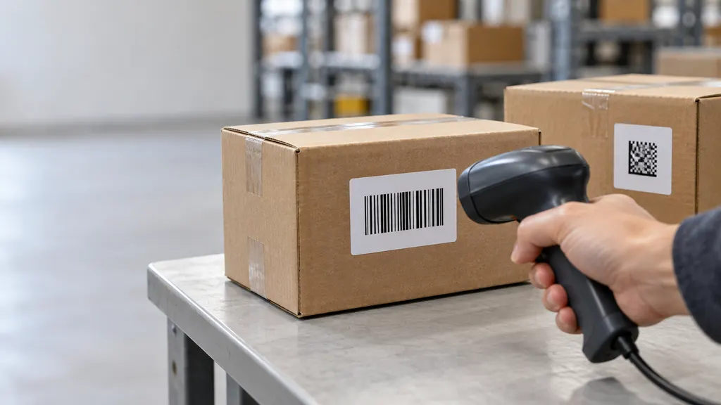
These distinctions matter when interpreting customer-facing tracking pages. A status such as arrival at a sorting facility may originate from a barcode scan rather than a GPS measurement. Conversely, a vehicle marker on a map may represent a reported coordinate without confirming a parcel-level handling event.
Accuracy and Operational Limitations
Signal reception and positioning accuracy
GPS accuracy is not a single fixed value. It depends on satellite geometry, signal blockage, atmospheric conditions, receiver design, and other factors. Signals reflected from nearby surfaces can introduce errors, a problem known as multipath. Buildings, tunnels, covered loading areas, and metal structures can obstruct or degrade reception.
For logistics, this means a position may be useful for identifying a vehicle's general location without being precise enough to distinguish adjacent loading bays. Indoor warehouse positioning should not be assumed to work reliably through GPS alone. Whether a location is suitable for a particular task depends on the required precision and the conditions in which it was measured.
Update frequency and data freshness
Continuous movement does not imply continuous reporting. A tracking device may calculate or transmit positions at configured intervals, and power-saving settings may reduce reporting frequency. Communication interruptions can create additional gaps. Describing a display as live or real-time should not obscure the age of the underlying measurement.
Interference and misleading signals
GPS reception can be disrupted by radio-frequency interference. Jamming can prevent usable reception, while spoofing involves misleading signals intended to produce incorrect positioning or timing information. An implausible location should therefore be investigated rather than automatically treated as proof of physical movement.
Limits of what location establishes
GPS measures the receiver's position, not the condition or legal status of goods. It does not directly establish package contents, temperature, damage, inventory quantity, customs release, or recipient identity. Those conclusions require separate sensors, records, or evidence. A tracking device also needs to remain correctly associated with the object it is intended to represent.
How to Interpret GPS-Based Logistics Information
Before using a location update to make an operational decision, check the following:
- Tracked object: Determine whether the marker represents a driver's phone, a vehicle-mounted unit, or a device attached to the cargo.
- Measurement timestamp: Check when the position was measured, not only when the application received or displayed it.
- Shipment association: Confirm that the shipment was assigned to the tracked vehicle or equipment at that time.
- Position quality: Review available accuracy or validity indicators before interpreting a coordinate as an exact location.
- Communication status: Distinguish a missing remote update from a confirmed loss of satellite positioning.
- Supporting records: Compare the location with scans, loading records, delivery documentation, or exception reports when the decision requires shipment-level evidence.
These checks help establish what a location record supports. They are especially useful when investigating an apparent route deviation, a disputed arrival, or a gap between vehicle movement and shipment status.
QA
Does a parcel tracking number mean the parcel has GPS?
No. A tracking number identifies a shipment in a tracking system. Updates may come from handling scans and operational records without a GPS device attached to the parcel.
Can GPS work without an internet connection?
Yes. A compatible receiver can calculate its position from satellite signals without internet access. Sending that position to a remote user requires a separate communication method.
Are GPS and GNSS the same thing?
Not exactly. GNSS is the broader category of satellite navigation systems, while GPS is one system within that category. Some receivers use signals from multiple systems.
Does a GPS position prove that a shipment was delivered?
No. A position can support a delivery record by showing where a device was located, but it does not independently confirm the recipient, the goods handed over, or completion of the delivery.
Sources
- GPS.gov: Global Positioning System — Official overview of GPS, its positioning and timing functions, and its space, control, and user segments.
- GPS.gov: GPS Accuracy — Factors affecting positioning accuracy, including signal blockage, satellite geometry, and receiver characteristics.
- GPS.gov: Roads and Highways — Transportation applications, including vehicle navigation, fleet management, and freight movement.
- GPS.gov: GPS Interference — Interference, jamming, and spoofing affecting GPS reception and use.